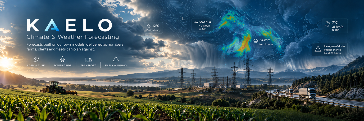
"Everyone plants, ships and switches on the grid against a guess about tomorrow. The difference between a good year and a lost one is often how far ahead that guess was right."
A forecast is not a convenience. It decides when a field is sown, how much power a grid holds in reserve, whether a road stays open and whether a warning arrives while there is still time to move.
KAELO forecasts weather and climate on its own models, and delivers the result as the specific numbers a farm, a plant or a fleet actually plans against.
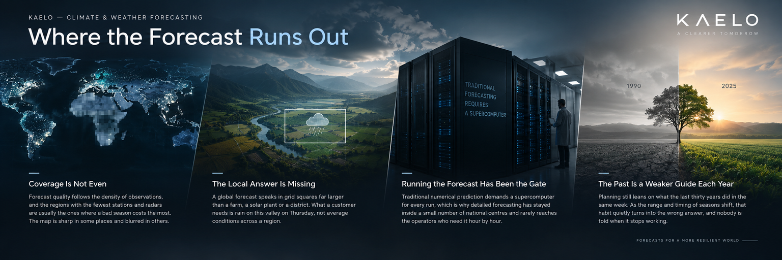
Forecast quality follows the density of observations, and the regions with the fewest stations and radars are usually the ones where a bad season costs the most. The map is sharp in some places and blurred in others.
A global forecast speaks in grid squares far larger than a farm, a solar plant or a district. What a customer needs is rain on this valley on Thursday, not average conditions across a region.
Traditional numerical prediction demands a supercomputer for every run, which is why detailed forecasting has stayed inside a small number of national centres and rarely reaches the operators who need it hour by hour.
Planning still leans on what the last thirty years did in the same week. As the range and timing of seasons shift, that habit quietly turns into the wrong answer, and nobody is told when it stops working.
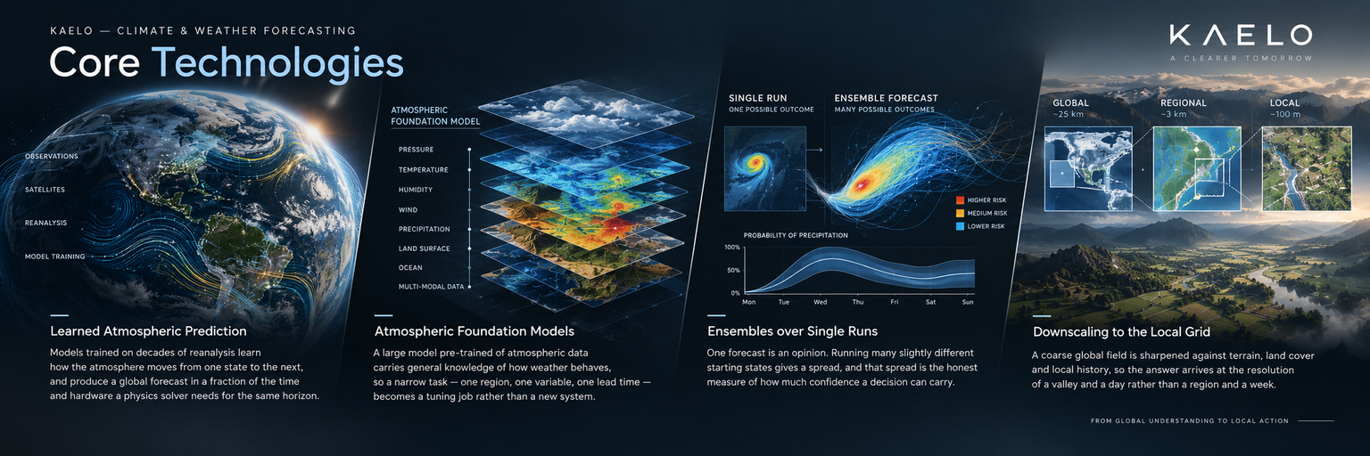
Models trained on decades of reanalysis learn how the atmosphere moves from one state to the next, and produce a global forecast in a fraction of the time and hardware a physics solver needs for the same horizon.
A large model pre-trained on atmospheric data carries general knowledge of how weather behaves, so a narrow task — one region, one variable, one lead time — becomes a tuning job rather than a new system.
One forecast is an opinion. Running many slightly different starting states gives a spread, and that spread is the honest measure of how much confidence a decision can carry.
A coarse global field is sharpened against terrain, land cover and local history, so the answer arrives at the resolution of a valley and a day rather than a region and a week.
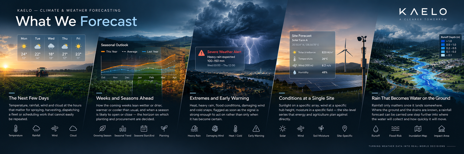
Temperature, rainfall, wind and cloud at the hours that matter for spraying, harvesting, dispatching a fleet or scheduling work that cannot easily be repeated.
How the coming weeks lean wetter or drier, warmer or cooler than usual, and when a season is likely to open or close — the horizon on which planting and procurement are decided.
Heat, heavy rain, flood conditions, damaging wind and cold snaps, flagged as soon as the signal is strong enough to act on rather than only when it has become certain.
Sunlight on a specific array, wind at a specific hub height, moisture in a specific field — the site-level series that energy and agriculture plan against directly.
Rainfall only matters once it lands somewhere. Where the ground and the drains are known, a rainfall forecast can be carried one step further into where the water will collect and how quickly it will move.
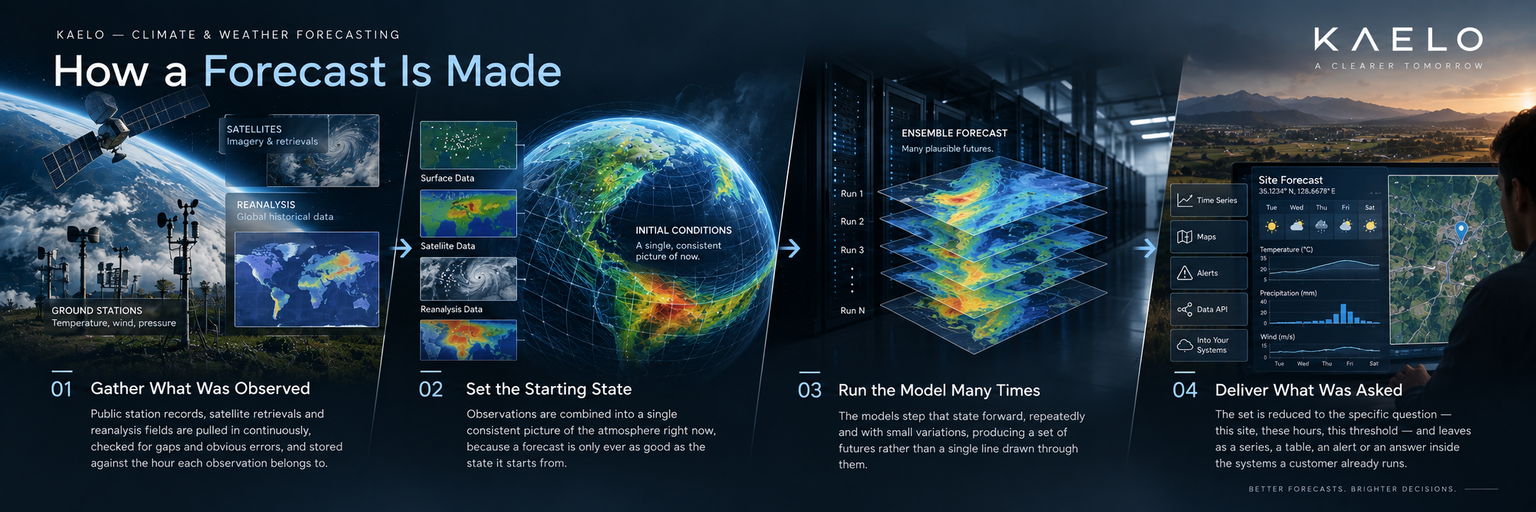
Public station records, satellite retrievals and reanalysis fields are pulled in continuously, checked for gaps and obvious errors, and stored against the hour each observation belongs to.
Observations are combined into a single consistent picture of the atmosphere right now, because a forecast is only ever as good as the state it starts from.
The models step that state forward, repeatedly and with small variations, producing a set of futures rather than a single line drawn through them.
The set is reduced to the specific question — this site, these hours, this threshold — and leaves as a series, a table, an alert or an answer inside the systems a customer already runs.
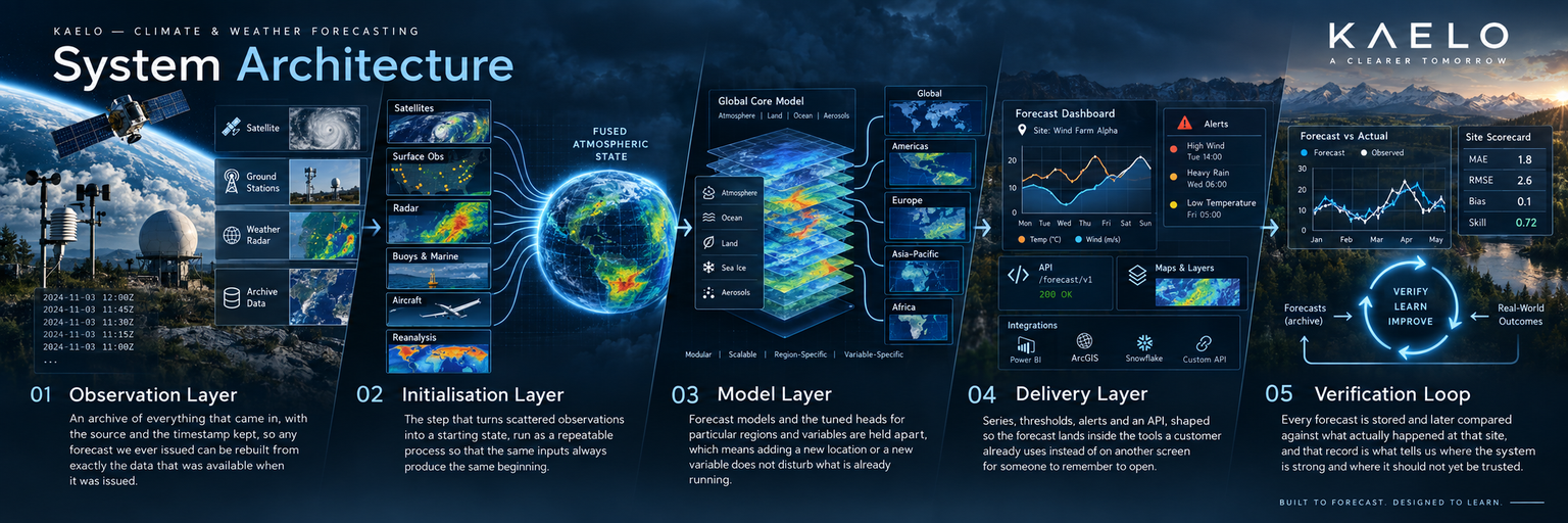
An archive of everything that came in, with the source and the timestamp kept, so any forecast we ever issued can be rebuilt from exactly the data that was available when it was issued.
The step that turns scattered observations into a starting state, run as a repeatable process so that the same inputs always produce the same beginning.
Forecast models and the tuned heads for particular regions and variables are held apart, which means adding a new location or a new variable does not disturb what is already running.
Series, thresholds, alerts and an API, shaped so the forecast lands inside the tools a customer already uses instead of on another screen for someone to remember to open.
Every forecast is stored and later compared against what actually happened at that site, and that record is what tells us where the system is strong and where it should not yet be trusted.
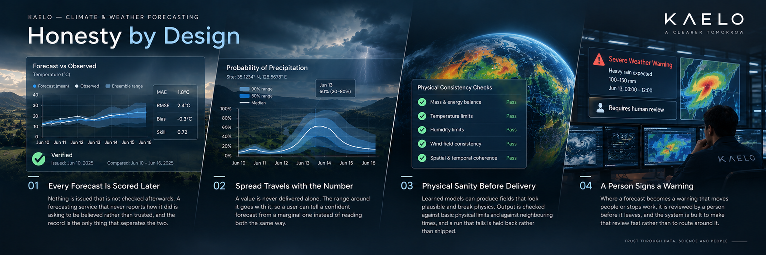
Nothing is issued that is not checked afterwards. A forecasting service that never reports how it did is asking to be believed rather than trusted, and the record is the only thing that separates the two.
A value is never delivered alone. The range around it goes with it, so a user can tell a confident forecast from a marginal one instead of reading both the same way.
Learned models can produce fields that look plausible and break physics. Output is checked against basic physical limits and against neighbouring times, and a run that fails is held back rather than shipped.
Where a forecast becomes a warning that moves people or stops work, it is reviewed by a person before it leaves, and the system is built to make that review fast rather than to route around it.
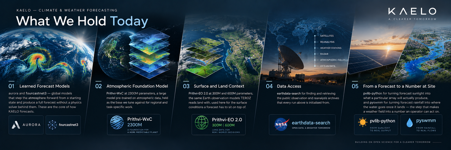
aurora and fourcastnet3 — global models that step the atmosphere forward from a starting state and produce a full forecast without a physics solver behind them. These are the core of how KAELO forecasts.
Prithvi-WxC at 2300M parameters, a large model pre-trained on atmospheric data, held as the base we tune against for regional and task-specific work.
Prithvi-EO 2.0 at 300M and 600M parameters, the same Earth observation models TEROZ reads land with, used here for the surface conditions a forecast has to sit on top of.
earthdata-search for finding and retrieving the public observation and reanalysis archives that every run above is initialised from.
pvlib-python for turning forecast sunlight into what a particular array will actually produce, and pyswmm for turning forecast rainfall into where the water goes once it lands — the step that makes a weather field into a number an operator can act on.
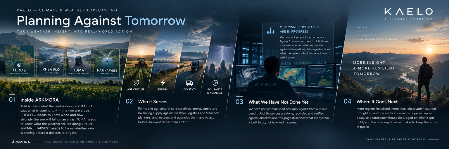
TEROZ reads what the land is doing and KAELO says what is coming to it — the two are a pair. RHEA FLO needs to know when and how strongly the sun will fall on an array, TUMA needs to know what the weather will do along a route, and MAJI HARVEST needs to know whether rain is coming before it decides to irrigate.
Farms and agricultural co-operatives, energy operators balancing supply against weather, logistics and transport planners, and insurers and agencies that have to act before an event rather than after it.
We have not yet published accuracy figures from our own bench. Until those runs are done, recorded and verified against observations, this page describes what the system is built to do, not how well it scores.
More regions initialised, more local observation sources brought in, and the verification record opened up — because a forecaster should be judged on what it got right, and the only way to allow that is to keep the score in public.
"Tomorrow is not knowable. It is, most of the time, calculable — and the difference is worth a season."
KAELO — Climate & Weather Forecasting.